Tuesday 4 August 2015

Day 8b: Hamstead Point to Yarmouth.

The beach section at Hamstead Point was very short before the path again turned inland and upward onto the cliffs. It was a beautiful pebble beach but spoilt in places by significant patches
of litter. However the variety of natural vegetation on the beach was an education.

The path up from the beach is fragile and dynamic  There was clear evidence of an old land slip and the new fencing has been diverted to allow for any new changes.


 The path climbed up around Hamstead Farm and other housing before descending again through heathland of the Forestry Commission. Blackberries were starting to ripen  but were sadly not as prolific as the sloes. On the way down Bouldnor Cliffs we were passed by two cyclists on a track that was heavily eroded and not suited for that activity.


We had a small glimpse of the sea near Bouldnor before heading south, through a nicely wooded area, to a lane leading to the busy A3054. Care is needed crossing the road to get to a grass verge on the LHS of the road. You follow this for a few hundred metres until a pavement starts on the RHS of the road. The "Coastal Path" follows the road most of the way into Yarmouth but you can get doen to the sea wall in places which is much less frought.


We arrived in Yarmouth around 2:30 pm. On passing the Wheatsheaf pub we saw the sign, shown in the picture below, outside the pub. It made us smile.


Day 8a: Shalfleet to Hamstead Point.

We caught the 8:50 am no:7 bus from Carisbrooke and in less than a quarter of an hour we were standing in the road outside the New Inn to start the last 7 miles of our round the IOW walk. Whereas yesterday was quite overcast this morning was sunny although there were clouds around. I estimated 70% clear sky when we were waiting for the bus.

Nearly opposite the New Inn was the Norman church of St.Michael  the Archangel. As we were not too pushed for time today Frau Barr suggested we might pay it a visit. If you are walking the Coastal Path, and are interested in old buildings,0 it is definitely worth a visit. We are short of space for pictures so we can only give you the outside view but the inside is also impressive, an interesting roof and some really beautiful stained glass.

From the church the 'Coastal Path' runs alongside the main road for about 3/4 mile. Although the road was very busy, at least today there was a grass verge for pedestrians on the RHS of the road. Interestingly, just before we reached the right turn off the road and into the fields/paddocks the skies darkened and a squally wind developed. It started to rain!!! We put on our rain/ wind jackets. However within 10 minutes the squall had passed and we packed our jackets away for good. ( Look how Frau Barr is dressed in the photographs). By the time she was crossing the foot bridge over Ningwood Lake (actually a small river entering Newtown Harbour) the wet weather gear was gone!


The path then joined a dusty dirt road which was not as quiet as one might expect . Four cars passed us in about 10 minutes, leaving clouds of dust behind them. The area was nicely shaded by trees but the lower foliage was covered in dust. Check out the first photograph below. Within half a mile the road branched to the right on the Hamstead Trail. At first the trees were very tall and fir like, and there was a lot of movement aloft, due to the wind. I was a little concerned about falling dead branches. Then suddenly the trees changed to mainly oak. The path had been climbing for a while and eventually we started to get the occasional view of the Solent through the trees. The track eventually descended to a sailing jetty on Newtown Harbour.


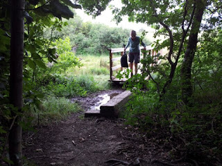
The path then continued around the Newtown River estuary to Hamstead Point. The path may have been waterlogged in some places at high tide an there were many bridges a d runs of duck boards needed to enable us to keep our feet dry. There were lots of wild flowers and today they seem to have attracted lots of moths and butterflies. Sadly I only managed to photograph one of them. The strong wind didn't help. I did manage to photograph some sloes however. They don't move around as much and were prolific.


Monday 3 August 2015

Day 7b: Shalfleet to West Cowes.

Be careful going through Thorness Bay Holiday Park as some of the Coastal Path signs may be still pointing incorrectly, as they were when we passed through. At the northern, seaward, side of the holiday camp is a wetland  area, a Site of Special Scientific Interest (SSSI). There are also many wild flowers bordering the fields leading from the wetland area.


Sadly, after less than a kilometer of coastline the path diverted back inland. The path first skirted in front of what appeared to be a number of baches (NZ for holiday home) before passing through, a sometimes muddy and very narrow path. The path then lead up beside a sweet corn paddock before eventually skirting a farm and heading back to the road.


Remarkably we got a roadsign suggesting lack of a footway may be a problem. We've had no footway for most of our walk today! We eventually met the sea again at Gurnard Bay but the reunion was short lived. There were extensive roadworks underway. After about 1/2 a mile however we did eventually reach the coast again and stayed with it all the way into West Cowes.


We stopped for tea and toasted tea cakes at Jollifes, a shoe shop, now converted to cafe. A very relaxing and informative interlude. We then walked down to take the chain ferry to East Cowes and our starting poit last Tuesday. Cost 40p per foot passenger.


We caught the no:5 bus to Newport where we had our evening meal and then caught the no: 12 bus to Carisbrooke. We used our 7 day rover ticket. They are cost effective and very convenient.

Day 7a: Shalfleet to West Cowes.

Some of you following this blog may have realised we have missed out a section, namely Yarmouth to Shalfleet.We intend walking that tomorrow but from Shalfleet to Yarmouth. The reason for the change is that the bus service to Shalfleet (no: 7) only runs every hour whereas buses to Yarmouth and Cowes run at least every half hour. We can catch the bus just outside our hotel in Carisbrooke. The wifi here is also very good and it is better to blog the longest section whilst we can. Today's walk was over 10 miles whereas tomorrows walk is about 7 miles.

Today's walk was like the curate's egg, good in parts. There were some pleasant wooded areas but too much road walking and less than 1km of coastal walking before the final promenade walk into Cowes.

We took the no: 7 bus again. All 7s run to Yarmouth but only every other bus runs through Shalfleet. We caught the 9:50 am bus.The trip was about a quarter of an hour. The bus stops almost opposite the New Inn in Shalfleet. It was a short road walk, a few 100 metres before we turned off onto a quiet farm track. The track crossed a small river, Caul Bourne, before entering a small wooded area, just before joining a road again.


We followed the road up towards Newtown, the old capital of the IOW, crossing Causeway Lake, one of the arms of Newtown Harbour. We turned right off the road, just past the old Newtown Town Hall and entered open fields.In one we saw a women crouching down. We believe she was counting a rare type of moth. A nice, but short wooded section followed after which we had a very long and hairy road section passing through Porchfield, with its abandoned pub. About a km past Porchfield we turned north, off the road, through fields towards South Thorness farm, with its innovative gate, and onto Thorness Bay Holiday Park with its futile stile and Coast Path signs misleadingly rotated.


Sunday 2 August 2015

Day 6: Freshwater Bay to Yarmouth.

We caught the no: 7 bus outside our hotel in Carisbrooke and travelled to Yarmouth. On the way, at one stop, we were overtaken by a large group of cyclists. As they did not travel in single file we were then behind them all the way to Yarmouth. In Yarmouth we then took the 'Needles Breezer' bus to Freshwater Bay, from where we had walked on Friday. The Breezer bus has a recorded audio commentary with lots of interesting background on the area. We arrived at Freshwater Bay around 10:20 am. After a quick look at the sea we set off up Tennyson Downs to the Tennyson monument. It is a very pleasant uphill walk but don't forget to look back from time to time as the view behind is sometimes better than the one ahead.


We then continued on to The Needles, passing a cyclist heading the other way. There are clear 'no cycling' signs on the gates to the downs.

At The Needles we paused to have our photograph taken before going into The Cold War rocketry establishment with a genuine cardboard replica of the control room. Here the rockets for Britain's one and only self launched space satellite were tested.


We then headed down behind Alum Bay to The Needles Park before heading back onto the cliffs at Headon Warren. There were good views back to The Needles and ahead over heather covered Warren. We then walked down a path to the sea atTotland surrounded by  brambles, heather, gorse and bracken. Some of the blackberries were ready to eat.


We were able to walk a short way along the promenade at Totland before the way was blocked by repairs being carried out because of storm damage.There followed a depressing series of diversions onto roads and through holiday camp areas. The final diversion finished at a horrendous extended modern coastal development just south of Fort Albert. The view across the Solent from Fort Albert towards Hurst Castle and Keyhaven was very  nostalgic for us as it is where we used to sail our Lark sailing dinghy more than 40 years ago! From Fort Albert onwards the way was through a very pleasant woodland area which led down to the promenade leading into Yarmouth.